
A
GUIDE TO FOUR WAY-MARKED TRAILS
WEST
WATERFORD, IRELAND
-
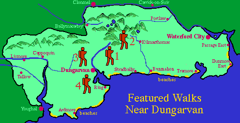
Walk 1: Colligan Woods beside Colligan RiverWalk 2: Cruahaun Hill and great viewsWalk 3: Brickey River on historic tow pathWalk 4: Famine Walk to 1847 graveyard and bay views
Trails 1 and 4 are short trails and 2 and 3 are of medium length.
All the routes have been marked at the start and succeeding intervals with special signposts. Walkers should use the maps in this guide in combination with the signposts. Take note that signs may be missing, or not readily visible from season to season necessitating reliance on the maps or indeed guesswork.
The narrative accompanying each trail gives:
- a description of features of interest that may be seen
- the location of the walk in relation to the town of Dungarvan
- an outline guide to following the trail
- the distance in miles and kilometres.
- the estimated time required to complete the walk
- suggested options to those indicated on the maps
Note: the time allowance assumes a leisurely pace, but takes no account of resting or any other delays.
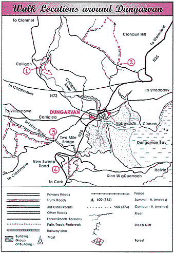
Observe the country code at all times